
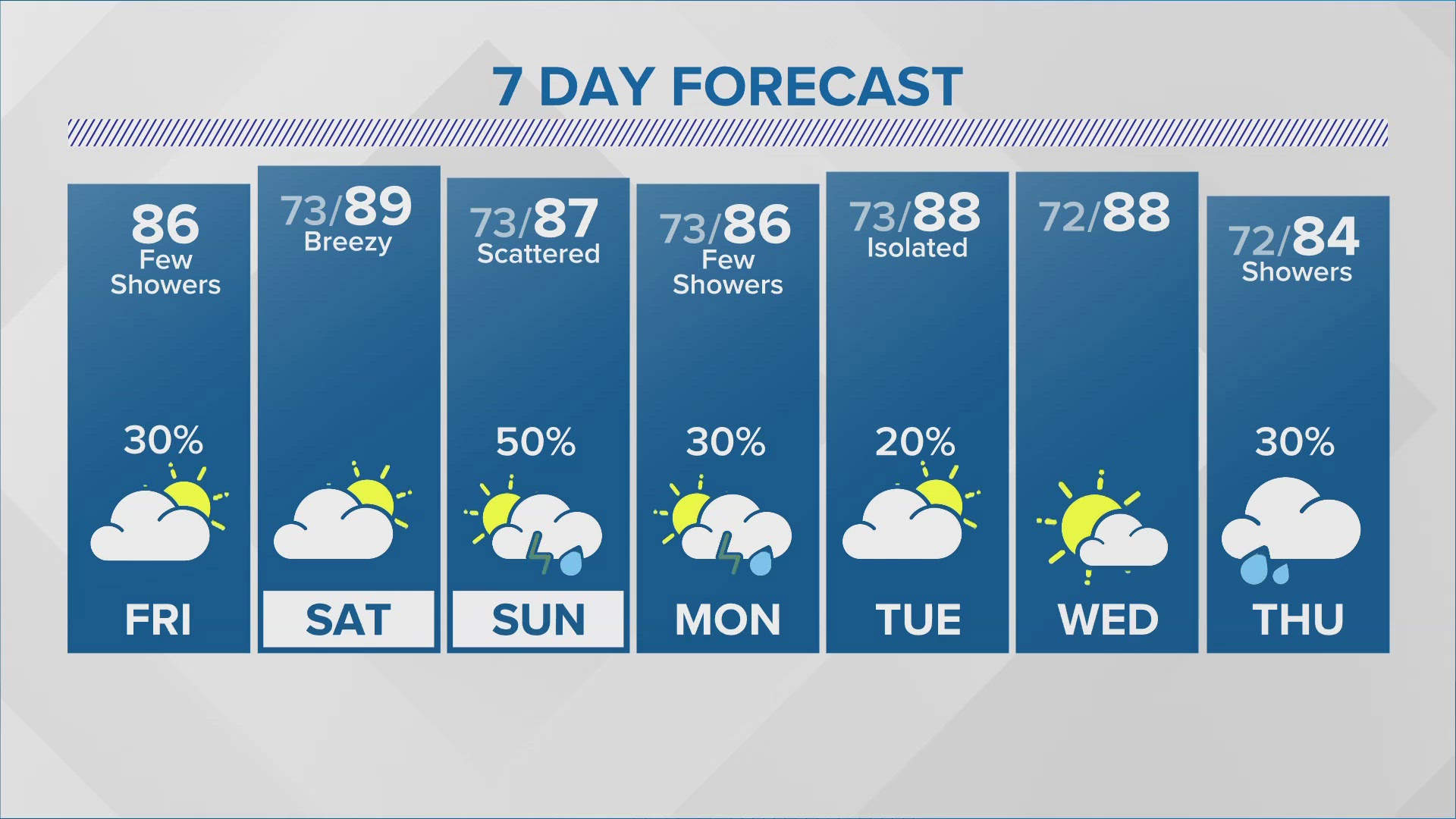
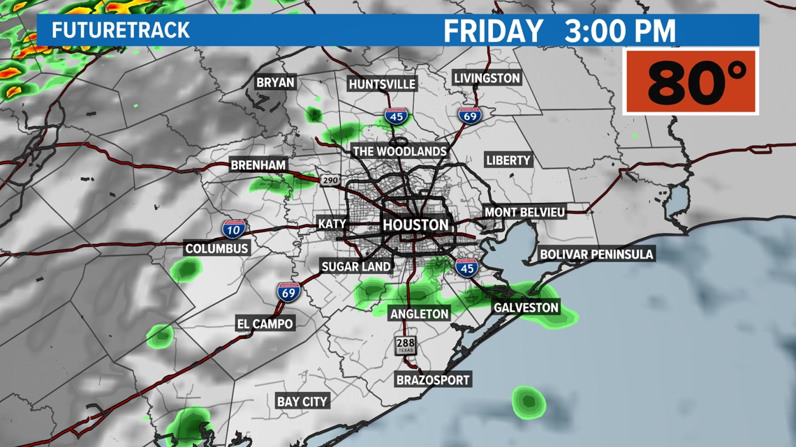
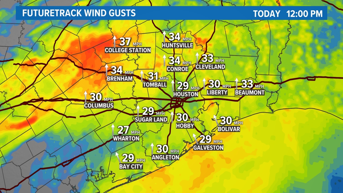
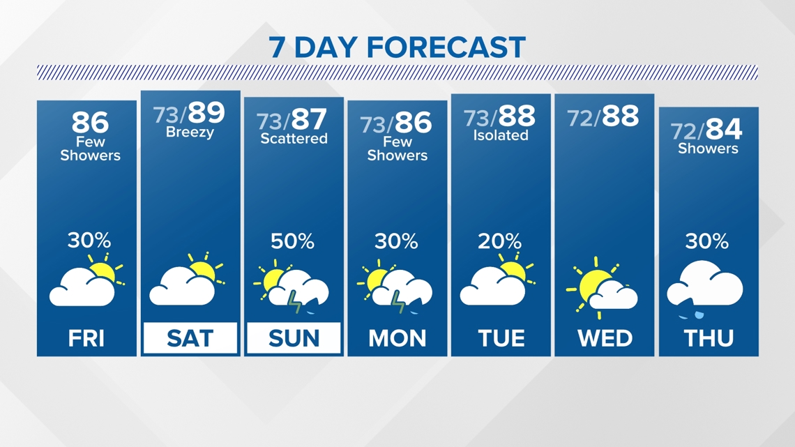
HOUSTON — Warm and breezy start to the day this Friday. A slow-moving frontal boundary will stall over southeast Texas and bring the chance for isolated showers and storms. Temperatures will reach in the mid 80s with winds out of the southeast Texas at 15-20 mph with winds gusting up to 28 mph.

The slow-moving frontal boundary will retreat back towards the north keeping rain chances slim to none on Saturday. However, winds will become strong out of the south at 25-30 mph. Saturday will also be warm and muggy with cloudy skies and afternoon temperatures reaching 86 degrees.

Sunday, rain and storm chances will ramp up on Sunday as a frontal boundary pushes over southeast Texas. Expect scattered showers and storms with afternoon temperatures reaching the lower 80s. We could see ponding on roadways lasting into Monday.

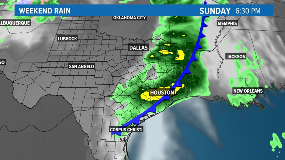
For the next seven days, expect muggy and warm temperatures with afternoon highs in the upper 80s. Each day will bring the chance of rain and showers with showers and storms ramping up on Sunday. As a frontal boundary sticks around, this will likely keep rain chances in the picture through next Tuesday.

Follow the KHOU Weather Team for live updates on the weather in your area:
- Kim Castro on social media: Facebook | X | Instagram
- Pat Cavlin on social media: Facebook | X | Instagram
- Chita Craft on social media: Facebook | X | Instagram
- David Paul on social media: Facebook | X | Instagram
- Chris Ramirez on social media: Facebook | X | Instagram
- KHOU 11 on social media: Facebook | X | Instagram | YouTube